Ross Island (ROS)
Antarctica
GRUAN Status
- active
- since 2018
- certified
- 2021
Site Name
- GRUAN (code, name)
- ROS, RossIsland
- -short
- Ross Island
Location
- Country
- Antarctica
- Latitude
- 77.85 °S
- Longitude
- 166.65 °E
- Altitude
- 10 to 200 m
Map
Site Contact for purposes of GRUAN activities
- Name
- Richard Querel
- Affiliation
- NIWA
- Address
- Lauder, State Highway 85, Central Otago, Private Bag 50061, Omakau
- Richard.querel@niwa.co.nz
- Phone
- +64 3 440 0400
- Fax
- +64 4 386 0574
The GRUAN site "Ross Island" is a cooperation from several organizations of two countries with three locations.
Site Locations
Location Name
- -long, international
- Arrival Heights Research Laboratory (N.Z.)
- -long, national
- Arrival Heights Research Laboratory
- WMO (code, name)
Position
- Latitude
- 77.82 °S
- Longitude
- 166.65 °E
- Altitude
- 200 m
Institution / Operator
- Name
- NIWA
- -long, international
- National Institute of Water & Atmospheric Research
- -long, national
- National Institute of Water & Atmospheric Research
- Website
- www.niwa.co.nz
- Description
- Arrival Heights infrastructure is owned and managed by Antarctica New Zealand, a New Zealand government agency. Instruments and measurements (with respect to GRUAN) are the responsibility of NIWA, a Crown Research Institute
Description of Location
- Foundation
- Description
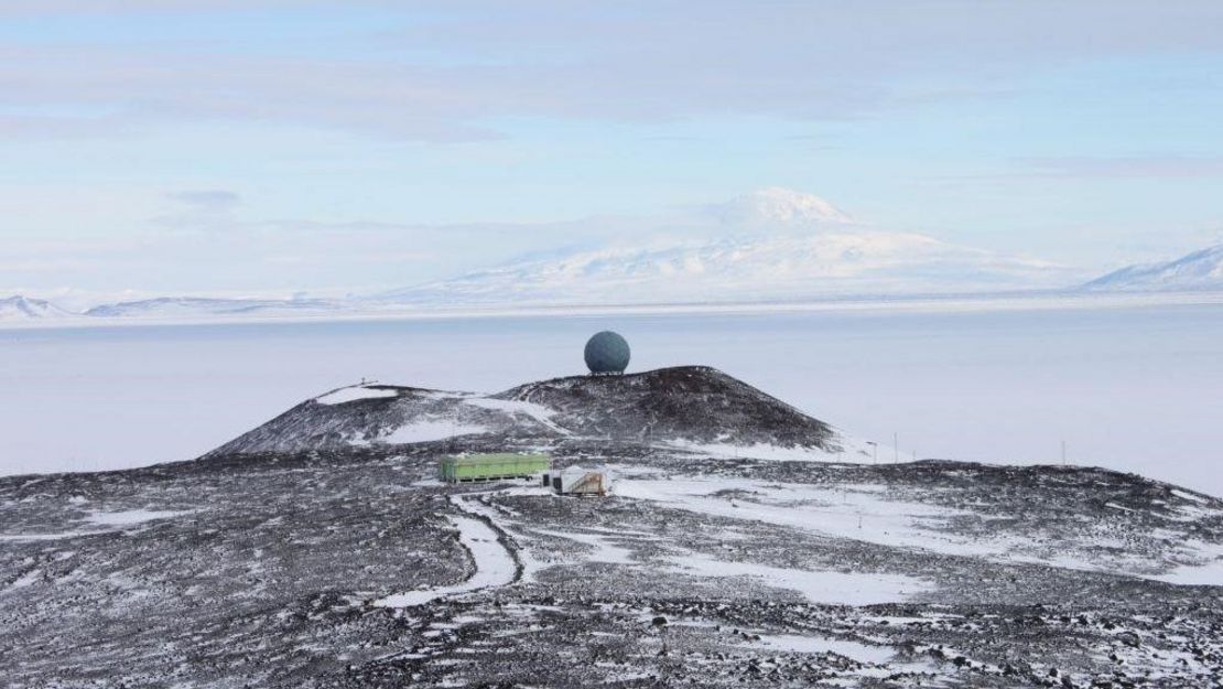
- Arrival Heights is located on Hut Point Peninsula, Ross Island, Antarctica. It is about 1.5 km north of McMurdo Station and 3 km northwest of Scott Base. The station is managed by Antarctica New Zealand (www.antarcticanz.govt.nz). Arrival Heights is located in Antarctic Specially Protected Area (ASPA 122); it is protected to prevent disturbance to an electromagnetically quiet and atmospherically clean area containing highly sensitive upper atmospheric equipment. Arrival Heights is a NDACC station with UVvis, FTIR and Dobson measurements.
- General type
- Remote polar. Permanent snow and ice (Surface cover types (GlobCover2009))
- Topography
- Volcanic crater morphology, a ridge at High relative elevation within ridges of low altitude
- Land use (within 10 km)
- Volcanic rock, Permanent snow and ice. The local area around the Arrival Heights laboratory is protected (ASPA-122). 1 km to the south is McMurdo station, ~500-1000 population during summer. Scott Base is ~3.5km to the south east, (50-100 population in summer). A road connects the laboratory to McMurdo and Scott Base road networks
- Climate
- Polar-frost, Seasonal break out of sea ice in summer
- Website
- http://www.ndaccdemo.org/stations/arrival-heights-antarctica
Membership In Other Networks
- NDACC
- since 1982 (station id: AHTS)
- GAW
- since 1987 (station id: ARH)
- WOUDC
- since 1988 (station id: 268)
History
Stratospheric chemical and upper wind measurements started at Arrival Heights in 1982 with zenith-sky NO2 UV/Vis spectroscopy (NIWA) and a MF radar (University of Canterbury). Total column ozone (NIWA, 1988), Spectral UV measurements (Biospherical inc. USA, 1988) and in situ flask sampling of greenhouse gases (NIWA, ~1987) were added in the late 1980s. Arrival Heights was a founding ‘secondary’ station of the NDSC (latter to be known as the NDACC) in the mid-1990s. During the 1990s additional UV and Infrared spectrometers were added to compliment the suite of measurements already there, with a strong focus on ozone heterogenous processes. Surface in situ ozone measurements started in 1996 (NOAA + NIWA). All such measurements continue to present (2019).
Location Name
- -long, international
- McMurdo Station (U.S.A.)
- -long, national
- McMurdo Station
- WMO (code, name)
- 89664
Position
- Latitude
- 77.85 °S
- Longitude
- 166.63 °E
- Altitude
- 10 m
Institution / Operator
- Name
- USAP
- -long, international
- United States Antarctic Program
- -long, national
- United States Antarctic Program
- Website
- https://www.usap.gov/
- Description
- The United States Antarctic Program (USAP) is managed by the National Science Foundation (NSF) Office of Polar Programs. The upper air programme at McMurdo is also managed by Naval Information Warfare Center, Atlantic.
Description of Location
- Foundation
- 1957
- Description
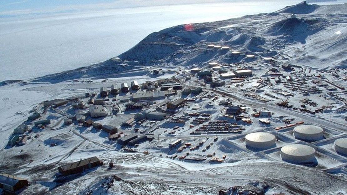
- McMurdo Station is Antarctica's largest community, established in 1957. It is built on the bare volcanic rock of Hut Point Peninsula on Ross Island, the farthest south solid ground that is accessible by ship. NDACC station (non-operative): lidar, uvvis, o3sonde
- General type
- Remote polar. Permanent snow and ice (Surface cover types (GlobCover2009))
- Topography
- Volcanic crater morphology, located at sea level at the end Hut Point Peninsula
- Land use (within 10 km)
- volcanic rock, Permanent snow and ice
- Climate
- Polar-frost, seasonal break out of sea ice in summer
Membership In Other Networks
- NDACC
- 1986
- GAW
- AERONET
- 1995
Current Aerological Soundings
Routine Radiosoundings
- Instrument-type
- RS41-SGP
- Manufacturer
- Vaisala
- Location of launch site
- at McMurdo station, balloon facility
- Lauch times (UTC)
- daily: 00, 12
- Instrument manager
- William Vandiver, Naval Information Warfare Center, Atlantic
History
Radiosonde launches since 1958
Location Name
- -long, international
- Scott Base (N.Z.)
- -long, national
- Scott Base
- WMO (code, name)
- 89665
Position
- Latitude
- 77.85 °S
- Longitude
- 166.78 °E
- Altitude
- 22 m
Institution / Operator
- Name
- Antarctica New Zealand
- -long, international
- Antarctica New Zealand
- -long, national
- Antarctica New Zealand
- Website
- https://www.antarcticanz.govt.nz/
- Description
- Antarctica New Zealand is the government agency responsible for carrying out New Zealand's activities in Antarctica, supporting world leading science and environmental protection. Scientific measurements and instrumentation are the responsibility of other institutions.
Description of Location
- Foundation
- 1957
- Description
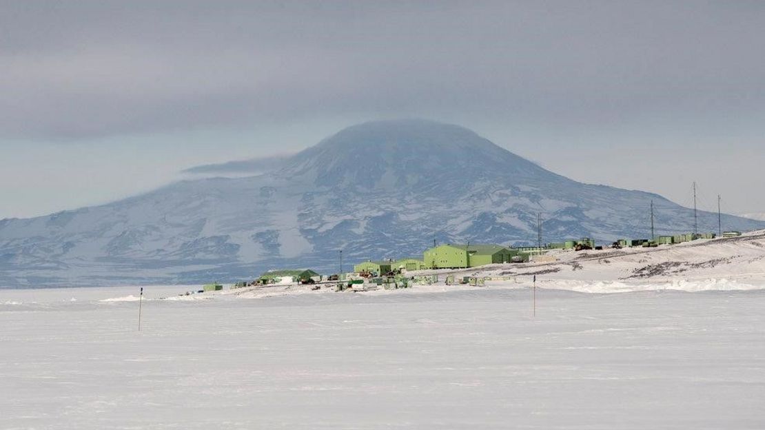
- Scott Base is located on Pram Point, the South eastern part of Hut Point Peninsula, ~2km east of McMurdo Station. Scott Base was built in 1957 and has been continually manned since. It is the logistical base for New Zealand’s scientific operations in Antarctica. During Summer base numbers vary between 50-100 personnel, down to 10-20 over Winter. A road connects Scott Base to McMurdo station.
- General type
- located at sea level at Pram Point
- Topography
- low volcanic headland
- Land use (within 10 km)
- volcanic rock, permanent snow and ice
- Climate
- Polar-frost, seasonal break out of sea ice in summer
- Website
- https://www.antarcticanz.govt.nz/scott-base
Membership In Other Networks
- NDACC
- since 1996
- WOUDC
- since 1992 (station id: 324)
- GAW
- (station id: SBS)
- GEONET
- (station id: SCTB)
History
Scott Base was built in 1957. It has gone thought a series of rebuilds. Surface level meteorological measurements started in 1957 and continues to today, supplemented with an automatic weather station in the 1990s (operated by NIWA). A GNSS receiver unit was installed in 2004, as part of the New Zealand’s GEONET network (https://www.geonet.org.nz/)
Relevant Documents
- ICM-15 (2024)
GRUAN Site Report for Ross Island - Richard Querel
- ICM-14 (2022)
GRUAN Site Report for Ross Island - Richard Querel
GRUAN Certification of Barrow/North Slope Alaska (BAR) and Ross Island (ROS)- ICM-13 (2021)
GRUAN Station Report for Ross Island - Richard Querel
- ICM-12 (2020)
GRUAN Site Report for Ross Island - Richard Querel
Measurement Systems
| Key | Name | Description | Instrument View | Instrument Change | ZIP |
|---|---|---|---|---|---|
| ROS-GN-01 | GNSS site SCTB | ||||
| ROS-RS-01 | Ross Island Radiosonde Launch Site (McMurdo) | ||||
| ROS-RS-02 | Ross Island Radiosonde Launch Site (Arrival Heights) |


